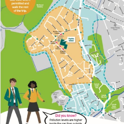
Haydon Walking Zone Map
Hillingdon council have been working with PWLC to produce Walking Zone Maps for selected schools in the borough to encourage more sustainable travel, less congestion around schools, better air quality for schools as well as promoting a better understanding of the schools’ surrounding areas.
Please see the attached Walking Zone Map for Haydon School below:
The map shows 10 and 15-minute walking zones around Haydon School. The maps are designed to reduce the level of traffic in the road outside the school and make it safer for pedestrians and cyclists. The Walk Zone map is an easy way for you to plan a more active travel to school by:
Showing those who live within the zones that they really do live close enough to walk
Supporting those who live outside of the zones and usually drive to school, to park and walk part of the way to school in order to stop lots of cars trying to park at the school gates.
